ARABIAN PLATE MAPS & REPORTS
The Middle East is, without doubt, one of our key areas of expertise. We offer three multiclient products, incorporating different elements of the Arabian Plate petroleum geology. Click on the contact the author button when viewing a report for further information, or contact us here.
Palaeogeographic Maps of the Arabian Plate Foreland Basin
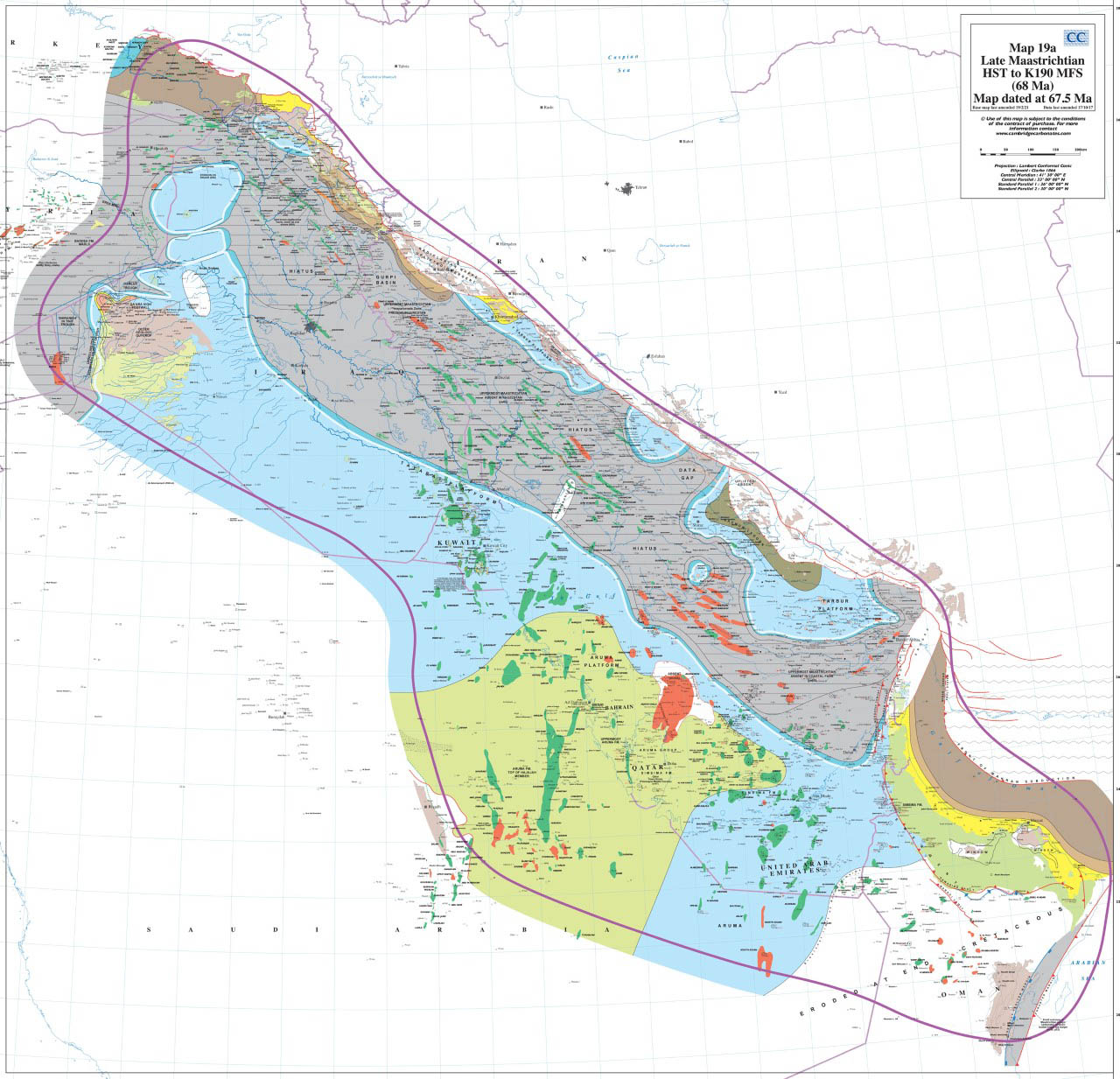
The Cambridge Carbonates database of palaeogeography maps for the Arabian Plate Foreland Basin have been extensively updated in 2021, with these revised maps available to purchase in pdf format. The palaeogeography maps are based on published data and more than 30 years experience in the Middle East and are produced within the Sharland et al. (2001, 2004) stratigraphic framework. For each 3rd order sequence, a map is available for the MFS, highstand, transgressive and lowstand system tract. In total >440 maps are available from the Precambrian through to the Quaternary.
Maps have been progressively constructed since 1993, using data derived and collated from publicly available sources. A voluminous quantity of information published in the last decade has been integrated.
Our maps are invaluable when evaluating acreage in bid rounds and allow detailed assessment of reservoir – seal – source combinations. The maps also provide our clients with a more regional understanding of their own acreage, which is often critical in exploration and development settings.
The maps can be purchased as a full set, or as a “bespoke” set which can be tailored to a client’s needs.
Click and image for a larger view
Preview Palaeogreographic Maps of Arabian Plate Foreland Basin Flyer
Please click for a sample…
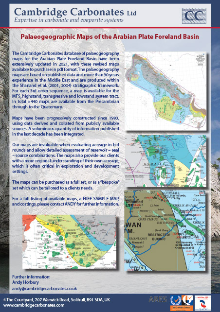
The maps can be purchased as a full set, or as a “bespoke” set which can be tailored to a clients needs. For a full listing of available maps, a FREE SAMPLE MAP, and costings, please contact ANDY for further information.
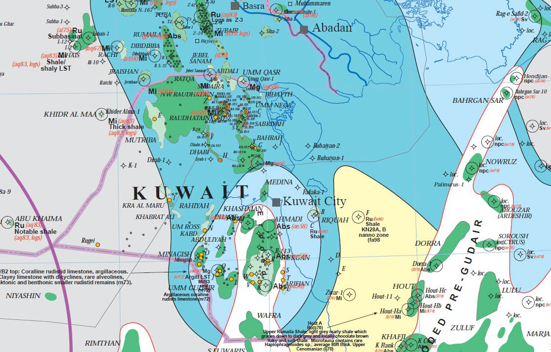
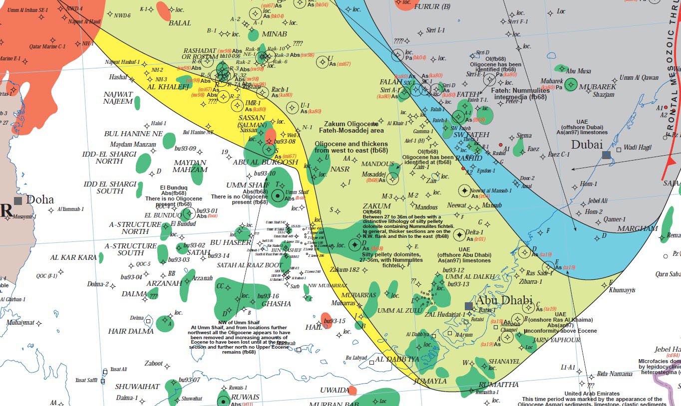
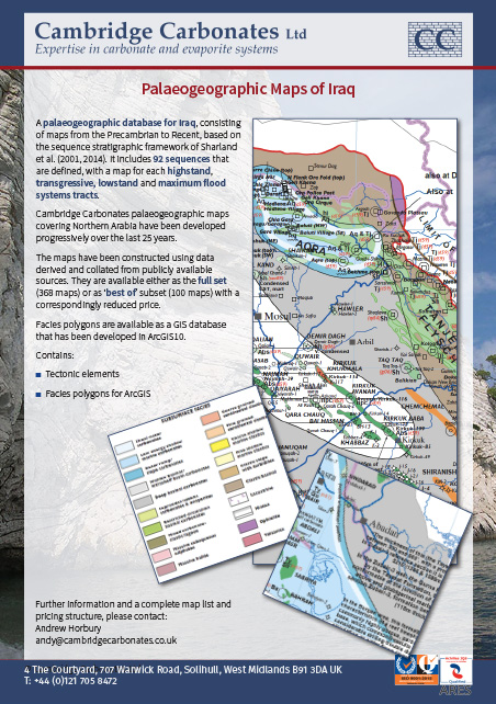
Palaeogeographic Maps of Iraq
Extensive palaeogeography database for the country of Iraq. Consisting of maps from the Precambrian to Recent, based on the sequence stratigraphic framework of Sharland et al. (2001, 2004).
92 sequences are defined, with a map for each of highstand, transgressive, lowstand and maximum flood systems tracts.
Cambridge Carbonate palaeogeographic maps covering Northern Arabia have been developed over the last 25 years.
Maps cover the whole of the Phanerozoic using data derived and collated from publicly available sources. In particular, the experience of co-producing the book “Petroleum Geology of Iraq” in 2010 led to acquisition of significant new or obscure data that has now been integrated into these maps.
Facies polygons that are found in the palaeogeographic maps are available as a GIS database that has been developed in ArcGIS.


Northern Iraq Report
A report on the petroleum geology of Northern Iraq. Interpretation based upon thirty years’ experience in the area and published work.
The report provides an overview of the regional geology (tectonics, stratigraphy, biostratigraphy, facies models). It also presents an analysis of the region’s petroleum geology as a compilation of data in the public realm on reservoirs, source rocks, and seals that is useful for explorationists. As part of this, the main fields in the area and aspects of development and production geology are described in detail. Integration of the regional geology review and the petroleum geological data is provided as a set of play maps based upon the distribution of regional seals above reservoirs.


Facies polygons that are found in the palaeogeographic maps are available as a GIS database that has been developed in ArcGIS.
- 386 pages
- 55 palaeogeography maps
- 18 play fairway maps
- 22 original figures and
- 63 redrafted figures.